Coastal Navigation and Anchoring in Inland Waterways of Australia
Where were you over the holidays? Sailing?
If you tried to email us over the holidays, you would have gotten a polite “out of the office notice”. We were busy catching up with our Canadian friends who have been sailing the world with their three kids for the past four years on a 42 ft PDQ Antares Catamaran. Early last year we meet up with them in New Zealand in the Tasman Bay (see the video in New Zealand). This year we meet with them in the inland water ways around Brisbane and the Gold Coast of Australia. Sailing with the Ellsay’s on Stray Kitty is a real insight to the lifestyle of world cruisers. They’ve certainly got it down and watching the kids in action with the lines and fenders was pretty impressive. This adventure was particularly interesting because of the intercoastal navigation issues in and around all the waterways. So here, I thought I’d relate a few stories as highlights of the issues and proof that both theory and practical knowledge is king.

Waterways south of Brisbane
One beautiful sunny afternoon we were anchored at a place called Jumpingpin. We went for a walk along the beach and came across a uniquely Australian experience by encountering a group of wallabies hoping across the sand.
")
Jumpingpin – A popular day stop (so long as you anchor properly)
After a nice stretch along the beach we returned to the boat just in time to beat an approaching thunderstorm. And in Ausy fashion, this one turned out to be a real beaut. About the time winds reached a peak of 40 knots we realized the washing was still on the lifelines and my bald head got a real pelting with the huge sideways rain drops as I brought in the now drenched washing. All the while that I was doing this, Chis, the skipper was pulling out fenders ready to fend off any of the at least ten yachts that were now dragging anchor.
To make matters worse, the tidal range in the area is around five feet. This creates particularly strong tidal currents in the narrow waterways. As the thunderstorm pelted us, the tidal current had risen to about 5 knots and was flowing in the same direction as the wind. This put huge forces on the anchors and it was pretty hair raising to see how fast the boats that had drug anchor were flying by. As an observation, almost all of the boats that had drug anchor and were now trying to reset them were using CQR plough type anchors.

The Dreaded CQR Anchor. Leave it at home.
Stray Kitty uses a Rocna roll type anchor and it held fast. Of course, in typical style of many boaters, the scope used was also way to low on boats that were dragging. And so we were able to watch the comedy of anchoring errors unfold in front of us. In reality there was no comedy. Some of the dragging boats were coming way too close, way too fast.

Boats anchored at Jumpingpin. Anchor scope too small and CQR Anchors caused dragging.
Next, one of the boats that re anchored abeam of us did it a bit too close and so as the current reversed later that night we began to come dangerously close. We elected to raise anchor and reset further out into the channel. However this presented quite a challenge with site selection. The wind was flowing in one direction whilst the current was in the other, and, we knew the current would again reverse before we awoke. Couple this with the difficulty in determining distance at night from other boats made us both glad of our previous anchoring experiences and knowledge. The worse scenario consequence of dragging anchor in the night and being washed out of the protected albeit high current waterway into the huge breakers coming in thought the cut was not one I wanted to spend to much time thinking about.
Another challenge was the markers. First off, Australia abides by IALA-A system which is opposite to the America’s IALA-B system of navigational marks. I.E. red right returning doesn’t work – it’s green on your right when returning. And in the USA the intercoastal water way fairly consistently uses green to seaward along the full length of a waterway with specially marked intercoastal day marks. IE heading from New Jersey past Florida and onto Texas you would keep green intercoastal daymarks on your left. In Queensland, they don’t seem do that and so the green and red swap inconsistently up and down the waterway.

Red Day Marker
Sometimes the red and green swap sides, some times they don’t. They seemed to use the yellow special purpose marks to designate a channel intersection rather than a preferred channel marker with red over green or green over red that is used in the USA.

Special Purpose Marks designating a channel intersection
Twice we were caught out nearly heading onto a sand bar because the day mark swapped over. The Australian navigation system also uses cardinal marks. Being able to read these quickly kept us out of trouble when it came to isolated dangers.

East Cardinal Mark (Safe Water to the East of this mark)
On top of all that, sand bars move and so your highly relied upon GPS map showing the exact position of the day marks can’t be trusted. When sand bars move the local coast guard move the day marks to remark the proper deep channel. So you can be looking at your GPS telling you that the channel is in one place when the marks tell you some thing else. Which do you trust? You have to trust the day marks.

Waterway Chart. Even with GPS don’t rely on the chart. Follow the day markers.
Twice we had to turn right angles to follow a day mark went the GPS was telling us that the depth was one foot. Of course a slow and easy pace combined with the depth sounder readings is essential. Still, when you have only two feet to play with below the keel, sometimes it’s not the greatest comfort.
We tried our best to time our sailings each day with the changing tidal current so that it would help our speed. On the day that we approached Surfers Paradise this was not the case however and our 7 knot though the water speed only gave us a three knot SOG (speed over ground) due to current. On one particular day we had to ensure that we crossed under powerlines at half tide or lower due to the height of Stray Kitty’s mast.
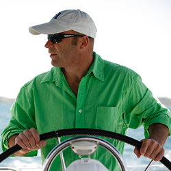
")
Under Sail (actually me just posing for the shot)
As hairy as I seem to have made the above sound, we definitely had a spectacular time visiting this area. It’s off the beaten track when it comes to top charter locations around the world and probably for good reason due to the complexity and also due to the spectacular and more popular Whitsundays area to the North.
There are two highly relevant NauticEd sailing courses to this article. The first is the NauticEd Anchoring a Sailboat Sailing Course. I’d venture to say that none of the power boats that drug anchor that day would have done so if they’d taken this course. First thing they’d have done was to leave the CQR in the garden at home and secondly they’d have understood scope a little better. Surely those people are embarrassed that they drug so badly.
The second course that would really help someone enjoy our intercoastal venture as much as we did would be the Coastal navigation sailing course. This course teaches in depth the navigation marks of both IALA-A and IALA-B systems including cardinal marks.
The other comfort to the whole trip was having very experienced world cruisers on board. After a hard day of tidal currents, thunderstorms, crazy reversing navigation day marks and shallow waters we were rewarded with gourmet type dinners under the southern sky. The crew of Stray Kitty, after living on their cat every day for the past four years, did not sacrifice food quality one bit and were even able to whip up a birthday cake for me on the 31st.
")
The Crew of Stray Kitty (next to their Christmas Tree)
Other tasty delights on the menu were kangaroo, pork roast, shrimp pasta, steaks, roast turkey, gammon (cooked in the oven on board), plenty of salads and cookies. Some great Australian and new Zealand wines were poured on top of the above in the warm southern hemisphere summer over the Christmas and 2011/2012 new year.

Christmas Dinner Table Setting Aboard Stray Kitty
Thanks to Stray Kitty and her Crew!!!!!!!!!!!
")
Christmas Dinner with Alexandra, Andrea, Grant, Ryan, Christine, Cari, Chris, (Vanessa photographer – Nikon D3100) on Stray Kitty – a 42 ft PDQ Antares Catamaran
- RYA Day Skipper with NauticEd - April 1, 2024
- NauticEd uses the SailTies GPS Tracking App - March 29, 2024
- Sea of Cortez Flotilla – February 2025 - March 8, 2024


